$549,900
Est. $3,173/mo
1746 Mt Olivet Church Rd
Elkton, VA 22827
Listed by Funkhouser Real Estate Group · Chris Monahan
5
beds
3
baths
3,246
sqft
About this home
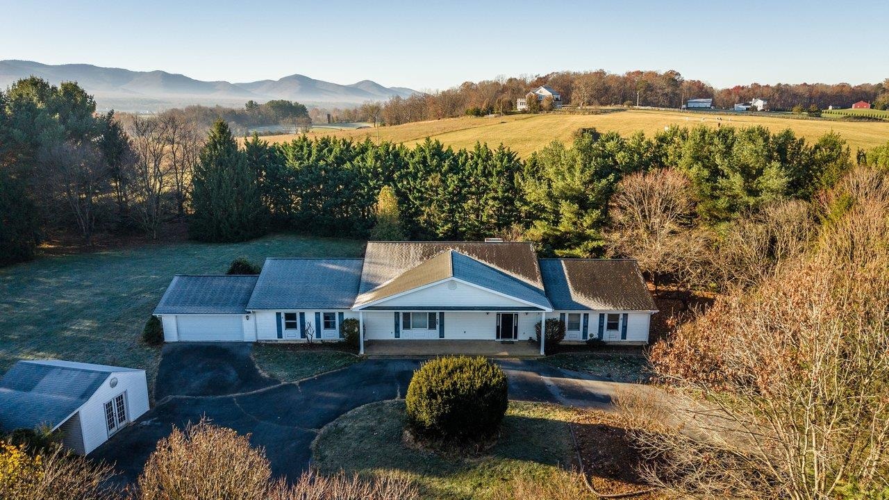
Enjoy spacious one-level living on 2.18 acres with views of Massanutten Peak and a private, inviting setting framed by mature trees. The yard balances open space with shaded areas, offering room to gather, garden, or simply enjoy the surroundings. A circular driveway and two-car garage provide ample parking, while the covered front porch offers a welcoming place to unwind. Inside, approximately 3,264 finished square feet include four generously sized bedrooms and three full baths—all on one level. The open kitchen and living area create a comfortable space for everyday living and entertaining, with both a gas stove and an electric stove providing cooking flexibility. A custom gas fireplace and custom bookcase add warmth and character, while the rear sunroom offers another relaxing spot to take in the setting. A storage shed provides additional space for tools and outdoor equipment. Enjoy the privacy of this setting with convenient access to the Shenandoah River, Massanutten Resort’s year-round activities, and local employers including Merck and Coors. With no HOA, this property offers possibilities as a full-time home, a Valley getaway, or a potential short-term rental.
Details
- Bedrooms
- 5
- Bathrooms
- 3
- Living area
- 3,246 sqft
- Price per sqft
- $169
- Lot
- 2.18 ac
- Year built
- 1992
- Type
- Residential
- Days on market
- 2
- MLS #
- 684257
Home details
Interior
- Heating
- Electric, Heat Pump
- Cooling
- Central AC, Heat Pump
- Appliances
- Dishwasher, Disposal, Gas Range, Island, Microwave, Pantry, Refrigerator, Wall Oven
- Primary bedroom on main level
- Yes
Structure & exterior
- Roof
- Composition Shingle
- Garage
- 2-Car Garage
Utilities
- Water & sewer
- Individual Well, Septic Tank
Lot & HOA
- Lot size
- 2.18 acres
- Zoning
- A-1 Agricu
- Subdivision
- None
Schools
- Elementary: McGaheysville
- Middle: Elkton
- High: East Rockingham
Location & lot
Parcel boundaries and aerial imagery are from the Virginia Geographic Information Network (Virginia Base Mapping Program); flood zones are from the FEMA National Flood Hazard Layer. All are approximate, provided for general reference only, and are not a survey, a title document, or an official flood determination. Verify boundaries with a licensed surveyor and flood status at FEMA's Flood Map Service Center.