$495,000
Est. $2,914/mo
2111 Viburnum Ct
Charlottesville, VA 22911 · North Pines
Listed by RE/MAX REALTY SPECIALISTS-CHARLOTTESVILLE · DOUG MCGOWAN
4
beds
2.5
baths
2,460
sqft
About this home
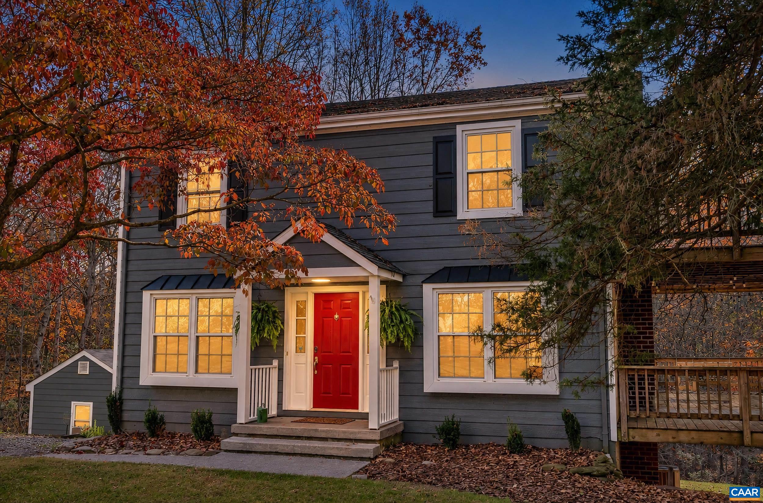
Welcome to 2111 Viburnum Ct, a 4-bedroom, 2.5-bath home on 2.09 acres in sought-after North Pines. Privacy, convenience and a spacious yard: wide stretches of lawn backed by mature woods. Gather around the statement fire pit on cool evenings with family and friends. A wraparound deck puts you in nature from every angle, and a private deck off the primary bedroom is your spot for morning coffee. Inside, 2,460 finished sq ft on 3 levels feature a gorgeous white kitchen, updated baths and beautiful true hardwood floors. The 300 sq ft lower-level sunroom has walls of sliding glass doors to enjoy the outdoors all year, perfect as an entertaining hub, office, playroom or studio. Major capital improvements are done, including a 1-year-old heat pump and Pella windows and doors. All this in growing Northern Albemarle, minutes from NGIC, UVA Research Park, Emerson, MicroAire and the airport, and near the North Fork of the Rivanna and Chris Greene Lake for kayaking, fishing and trails. You get country privacy with an easy commute.
Details
- Bedrooms
- 4
- Bathrooms
- 2.5
- Living area
- 2,460 sqft
- Price per sqft
- $201
- Lot
- 2.09 ac
- Year built
- 1981
- Type
- Residential
- Days on market
- 1
- MLS #
- 684253
Home details
Interior
- Heating
- Heat Pump
- Cooling
- Heat Pump
- Fireplaces
- Brick, Gas Logs, Two, Wood Burning
- Appliances
- Breakfast Bar, Dishwasher, Eat-in, Electric Range, Microwave, Recessed Light, Refrigerator
- Basement
- Finished, Full, Heated, Inside Access, Outside Entrance, Slab, Walk Out, Windows · 1,020 sqft finished
- Primary bedroom on main level
- No
Structure & exterior
- Style
- Colonial
- Roof
- Architectural Style
Utilities
- Water & sewer
- Public Water Available, Septic Tank
Lot & HOA
- Lot size
- 2.09 acres
- Zoning
- RA Rural A
- Subdivision
- North Pines
Schools
- Elementary: Baker-Butler
- Middle: Lakeside
- High: Albemarle
Location & lot
Parcel boundaries and aerial imagery are from the Virginia Geographic Information Network (Virginia Base Mapping Program); flood zones are from the FEMA National Flood Hazard Layer. All are approximate, provided for general reference only, and are not a survey, a title document, or an official flood determination. Verify boundaries with a licensed surveyor and flood status at FEMA's Flood Map Service Center.