$3,250,000
Truevine Rd
Glade Hill, VA 24092
Listed by HALL AND HALL PARTNERS, LLP · KEVIN REINEMUND
1,174
acres
Acreage
type
A-1
zoning
About this property
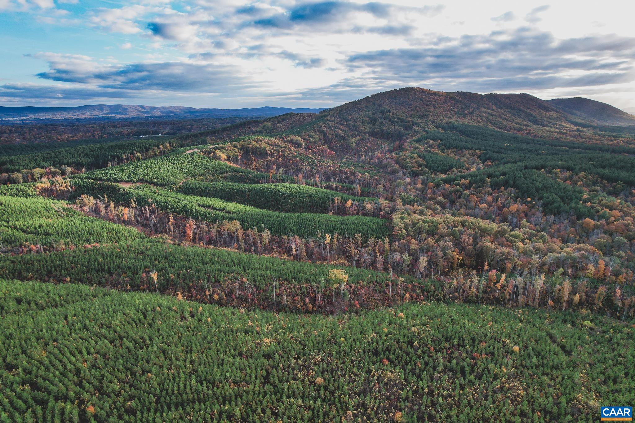
Set within the rolling hills of Franklin County, Virginia, the Pigg River tracts comprise over 1,100 acres less than 25 minutes from Smith Mountain Lake and under an hour from Roanoke. The property features miles of Pigg River frontage, along with multiple creeks that add even more flowing water to the offering. In total, 906± acres are planted in elite loblolly pine under an active Virginia Forest Stewardship Management Plan, complemented by 140± acres of riparian buffers and natural forest. Miles of trails, a rustic cabin, mountain views, and power routed to the property add to the appeal and opportunities. Abundant whitetail deer, turkey, black bear, along with smallmouth bass and sunfish in the river, make this an exceptional recreational retreat or long-term timber investment. There are multiple access points with road frontage along Truevine Road, Snow Creek Road, and Chestnut Mountain Road. Offered as a whole, Pigg River consists of two non-contiguous properties that are within very close proximity. A 520± acre western tract and a 654± acre eastern tract, located just minutes apart via Truevine Road, provides the flexibility to enjoy the scale of a single holding or capitalize on the future resale of either tract.
Details
- Acreage
- 1,174
- Type
- Acreage
- Zoning
- A-1
- Water
- None
- Days on market
- —
- MLS #
- 684199
Land details
Utilities
- Water & sewer
- None
Lot & HOA
- Lot size
- 1174 acres
- Zoning
- A-1
- Subdivision
- None
Schools
- Elementary: Snow Creek
- Middle: Benjamin Franklin
- High: Franklin (Franklin County)
Location & lot
Parcel boundaries and aerial imagery are from the Virginia Geographic Information Network (Virginia Base Mapping Program); flood zones are from the FEMA National Flood Hazard Layer. All are approximate, provided for general reference only, and are not a survey, a title document, or an official flood determination. Verify boundaries with a licensed surveyor and flood status at FEMA's Flood Map Service Center.