$399,000
Est. $2,373/mo
10 Foliage Cir
Stuarts Draft, VA 24477 · Cranberry Hills
Listed by REAL BROKER LLC · BURKS HOME GROUP TEAM
3
beds
2.5
baths
1,738
sqft
About this home
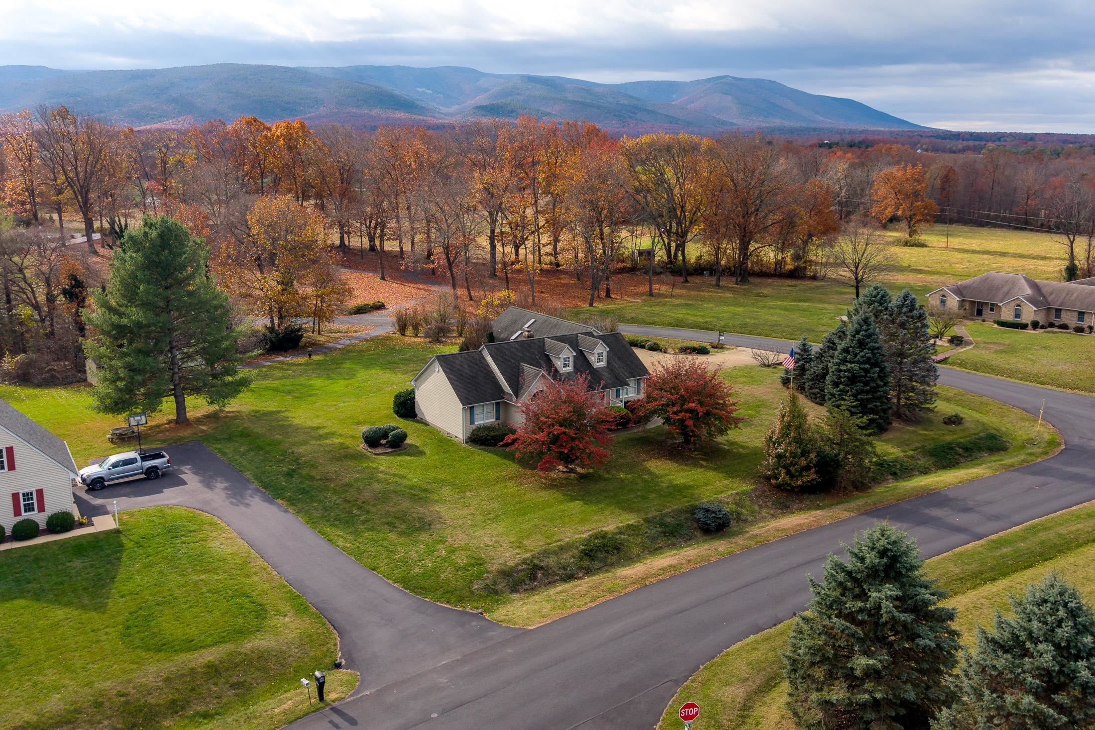
Mountain views, fall color and room to breathe! Set on more than an acre in Stuarts Draft’s sought-after Cranberry Hills, this one-level charmer makes a great first impression with its rocking-chair front porch and storybook landscaping. Inside, cozy up by the fireplace in the living room, then head to the sunny eat-in kitchen with gleaming hardwoods, warm oak cabinets and a formal dining room just steps away for holidays and dinner parties. The showstopper is the sunroom: walls of windows, exposed brick and French doors to a sprawling multi-level deck overlooking a wide-open backyard made for cookouts, gardening and sunsets over the Blue Ridge. The primary suite is a true retreat with a double vanity, soaking tub and separate shower, and one bedroom has a dramatic vaulted ceiling and arched window. Car lovers and hobbyists, take note: there’s an attached 2-car garage, plus a skylit breezeway leading to a separate 1-car garage that’s perfect for a workshop, extra vehicle or weekend toys. Two sheds add even more storage. Quiet circle, big views, minutes to Waynesboro, Staunton and I-64. Come see it before someone else does!
Details
- Bedrooms
- 3
- Bathrooms
- 2.5
- Living area
- 1,738 sqft
- Price per sqft
- $230
- Lot
- 1.07 ac
- Year built
- 1996
- Type
- Residential
- Days on market
- —
- MLS #
- 684197
Home details
Interior
- Heating
- Forced Air
- Cooling
- Central AC
- Fireplaces
- One
- Appliances
- Dishwasher, Eat-in, Electric Range, Microwave, Refrigerator
- Primary bedroom on main level
- Yes
Structure & exterior
- Garage
- 3-Car Garage
Utilities
- Water & sewer
- Public Water, Septic Tank
Lot & HOA
- Lot size
- 1.07 acres
- Zoning
- SF12
- Subdivision
- Cranberry Hills
Schools
- Elementary: Riverheads
- Middle: Riverheads
- High: Riverheads
Location & lot
Parcel boundaries and aerial imagery are from the Virginia Geographic Information Network (Virginia Base Mapping Program); flood zones are from the FEMA National Flood Hazard Layer. All are approximate, provided for general reference only, and are not a survey, a title document, or an official flood determination. Verify boundaries with a licensed surveyor and flood status at FEMA's Flood Map Service Center.