$875,000
Est. $5,245/mo
655 Pedlars Edge Dr
Wintergreen Resort, VA 22967 · Wintergreen Mountain Village
Listed by PEAK REALTY VIRGINIA, LLC · DIMA HOLMES
5
beds
4.5
baths
3,078
sqft
About this home
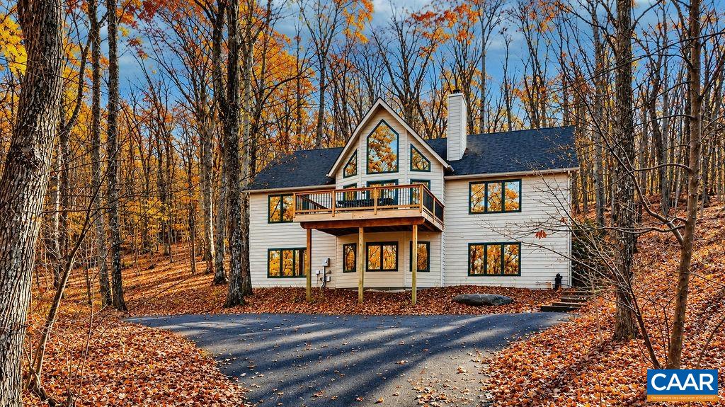
Mountain luxury meets exceptional location! This beautifully designed 5-bedroom, 4.5-bath home in Wintergreen offers panoramic seasonal mountain views for approximately six months of the year and convenient walking access to a public easement leading to the Tyro ski slope. Situated on two combined lots totaling 1.17 acres, the home offers privacy, space, and a wonderful mountain setting. The bright, open-concept great room, kitchen, and dining area create an inviting space for entertaining, while the spacious lower-level family room provides a second gathering area. Three ensuite bedrooms offer added comfort and privacy for family and guests. Thoughtfully designed for mountain living, the home features a large lower-level entry mudroom with a sink, perfect after a day on the slopes or trails. Energy-efficient SIP construction, durable HardiePlank siding, and low-maintenance Trex decking add lasting value. Offered turnkey furnished and ready to enjoy from day one!
Details
- Bedrooms
- 5
- Bathrooms
- 4.5
- Living area
- 3,078 sqft
- Price per sqft
- $284
- Lot
- 1.17 ac
- Year built
- 2005
- Type
- Residential
- Days on market
- —
- MLS #
- 684194
Home details
Interior
- Heating
- Central Heat, Dehumidifier, Electric
- Cooling
- Central AC, Heat Pump
- Fireplaces
- Wood Burning
- Appliances
- Breakfast Bar, Dishwasher, Disposal, Electric Range, Microwave, Pantry, Recessed Light, Refrigerator
- Basement
- Finished, Full, Heated, Inside Access, Outside Entrance, Slab, Walk Out, Windows · 1,423 sqft finished · 232 sqft unfinished
- Primary bedroom on main level
- Yes
Structure & exterior
- Style
- Craftsman
- Roof
- Architectural Style
Utilities
- Water & sewer
- Public Water, Public Sewer
Lot & HOA
- Lot size
- 1.17 acres
- Zoning
- R Resident
- HOA
- 2279
- Subdivision
- Wintergreen Mountain Village
Schools
- Elementary: Rockfish
- Middle: Nelson
- High: Nelson
Location & lot
Parcel boundaries and aerial imagery are from the Virginia Geographic Information Network (Virginia Base Mapping Program); flood zones are from the FEMA National Flood Hazard Layer. All are approximate, provided for general reference only, and are not a survey, a title document, or an official flood determination. Verify boundaries with a licensed surveyor and flood status at FEMA's Flood Map Service Center.