$224,900
Est. $1,392/mo
102 Stagg Ave
Deerfield, VA 24432
Listed by REAL BROKER LLC · MYRA BEAMS
3
beds
2
baths
2,011
sqft
About this home
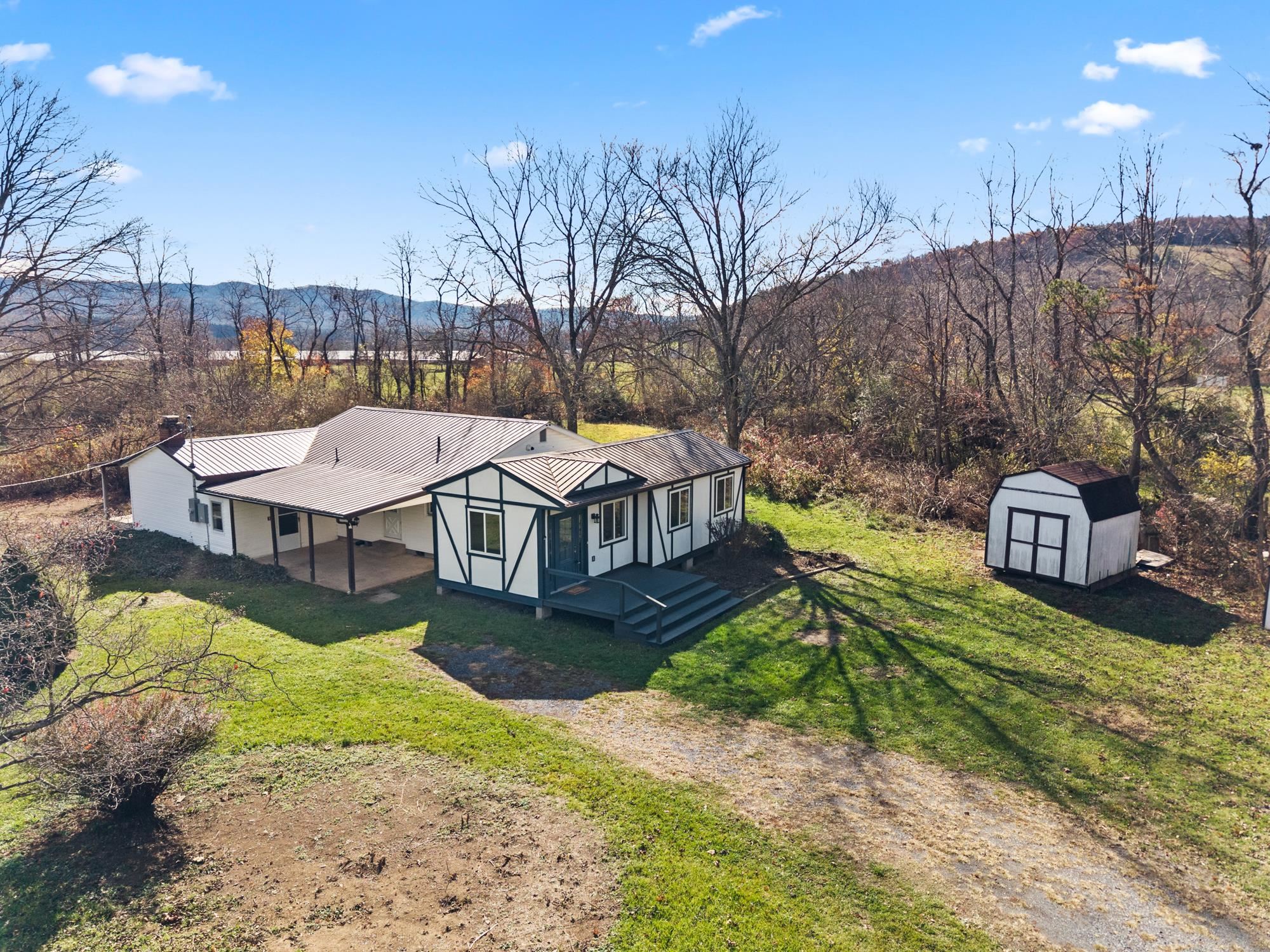
PRIVATE COUNTRY RETREAT ON 5+ ACRES WITH MOUNTAIN VIEWS AND A STREAM! Tucked away at the end of the road, this inviting 3-bedroom, 2-bath home offers the privacy, peaceful surroundings, and room to roam you've been looking for! Recent improvements include fresh interior paint, new LVP flooring, new kitchen appliances, and a new 200-amp electrical panel. The primary bedroom features its own fireplace and opens directly to a covered back porch—the perfect spot for morning coffee while enjoying the sights and sounds of nature. The primary bath adds an unexpected touch of luxury with heated floors. Outside, the 5+ acres offer a beautiful combination of mountain views, a stream, and plenty of space for gardening, recreation, or simply enjoying the outdoors. A 20' x 14' "she shed" offers exciting possibilities for a studio, workshop, hobby space, or private retreat, with electrical and plumbing connections still needed. Located near National Forest land, this property is ideal for those who appreciate hiking, outdoor recreation, and the natural beauty of the Shenandoah Valley. Privacy, mountain scenery, and comfortable country living—all in one special property!
Details
- Bedrooms
- 3
- Bathrooms
- 2
- Living area
- 2,011 sqft
- Price per sqft
- $112
- Lot
- 5.17 ac
- Year built
- 1970
- Type
- Residential
- Days on market
- 1
- MLS #
- 684089
Home details
Interior
- Heating
- Baseboard, Electric, Propane
- Cooling
- Wall Unit(s)
- Fireplaces
- Brick, Gas Logs, Two, Wood Burning
- Appliances
- Dishwasher, Eat-in, Electric Range, Refrigerator
- Basement
- Crawl
- Primary bedroom on main level
- Yes
Structure & exterior
- Style
- Ranch,Rustic
- Roof
- Metal - Tin
Utilities
- Water & sewer
- Individual Well, Septic Tank
Lot & HOA
- Lot size
- 5.17 acres
- Zoning
- R Resident
- Subdivision
- None
Schools
- Elementary: Churchville
- Middle: Buffalo Gap
- High: Buffalo Gap
Location & lot
Parcel boundaries and aerial imagery are from the Virginia Geographic Information Network (Virginia Base Mapping Program); flood zones are from the FEMA National Flood Hazard Layer. All are approximate, provided for general reference only, and are not a survey, a title document, or an official flood determination. Verify boundaries with a licensed surveyor and flood status at FEMA's Flood Map Service Center.