$309,000
Est. $1,866/mo
17 Ken View Ave
Verona, VA 24482 · Skyview
3
beds
2
baths
1,504
sqft
About this home
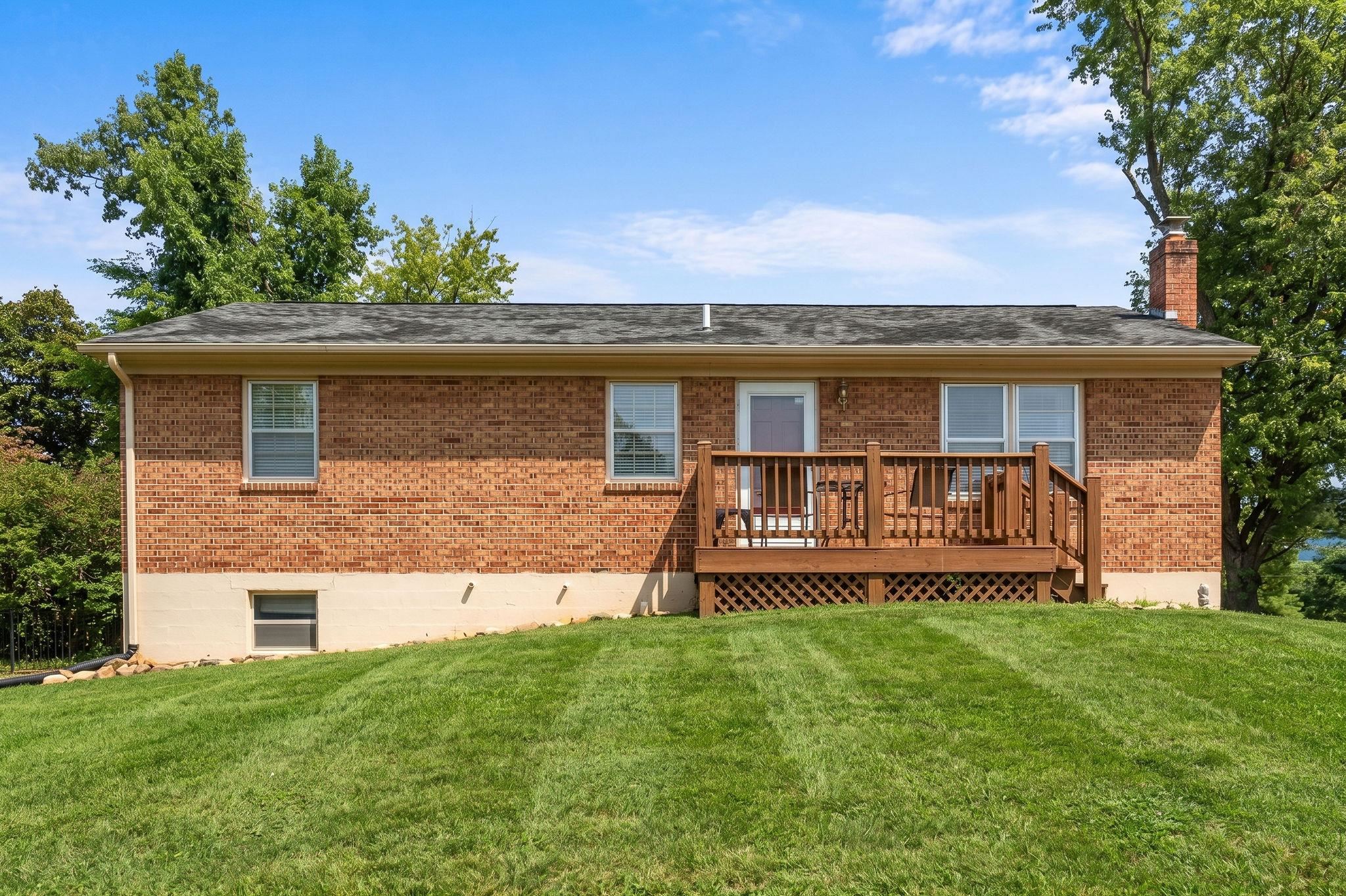
Welcome to 17 Ken View Avenue in the Skyview neighborhood, designed for everyday living, entertaining, making memories, and enjoying beautiful mountain views! This property offers a comfortable and functional layout with plenty of space both inside and out. The large living room provides a welcoming gathering space, while the spacious kitchen offers room to cook, entertain, and dine. Step outside to the fenced-in backyard, perfect for relaxing, gardening, or just to enjoy time outdoors. The basement adds even more versatility, featuring a full bath, designated office or media room, space to expand, shelving for all your storage needs, and a dedicated workshop area for hobbies, projects, or extra workspace. The current owners of 23 years have completed several important updates during their tenure, including an electrical square D 200 am distribution box, updated PEX plumbing, new dimmable LED lighting throughout, and installation of an Owen Corning 30-year roof in 2011. These improvements add peace of mind for the next owners. This well-maintained brick ranch in Augusta County has easy access to Staunton, Waynesboro, Charlottesville and Harrisonburg via I-81 and I-64. It is ready for new owners. Sellers are motivated!
Details
- Bedrooms
- 3
- Bathrooms
- 2
- Living area
- 1,504 sqft
- Price per sqft
- $205
- Lot
- 0.26 ac
- Year built
- 1984
- Type
- Residential
- Days on market
- 46
- MLS #
- 682545
Home details
Interior
- Heating
- Baseboard, Electric
- Cooling
- Window Unit(s)
- Basement
- Inside Access, Outside Entrance, Partly Finished · 429 sqft finished · 646 sqft unfinished
- Primary bedroom on main level
- Yes
Structure & exterior
- Roof
- Composition Shingle
Utilities
- Water & sewer
- Public Water, Public Sewer
Lot & HOA
- Lot size
- 0.26 acres
- Zoning
- SF10
- Subdivision
- Skyview
Schools
- Elementary: E. G. Clymore
- Middle: S. Gordon Stewart
- High: Fort Defiance
Location & lot
Parcel boundaries and aerial imagery are from the Virginia Geographic Information Network (Virginia Base Mapping Program); flood zones are from the FEMA National Flood Hazard Layer. All are approximate, provided for general reference only, and are not a survey, a title document, or an official flood determination. Verify boundaries with a licensed surveyor and flood status at FEMA's Flood Map Service Center.