$275,000
Est. $2,030/mo
1140 Mill Park Drive Ext
Charlottesville, VA 22901 · Brookmill
Listed by BETTER HOMES & GARDENS R.E.-PATHWAYS · MARJORIE ADAM
2
beds
2.5
baths
1,427
sqft
About this home
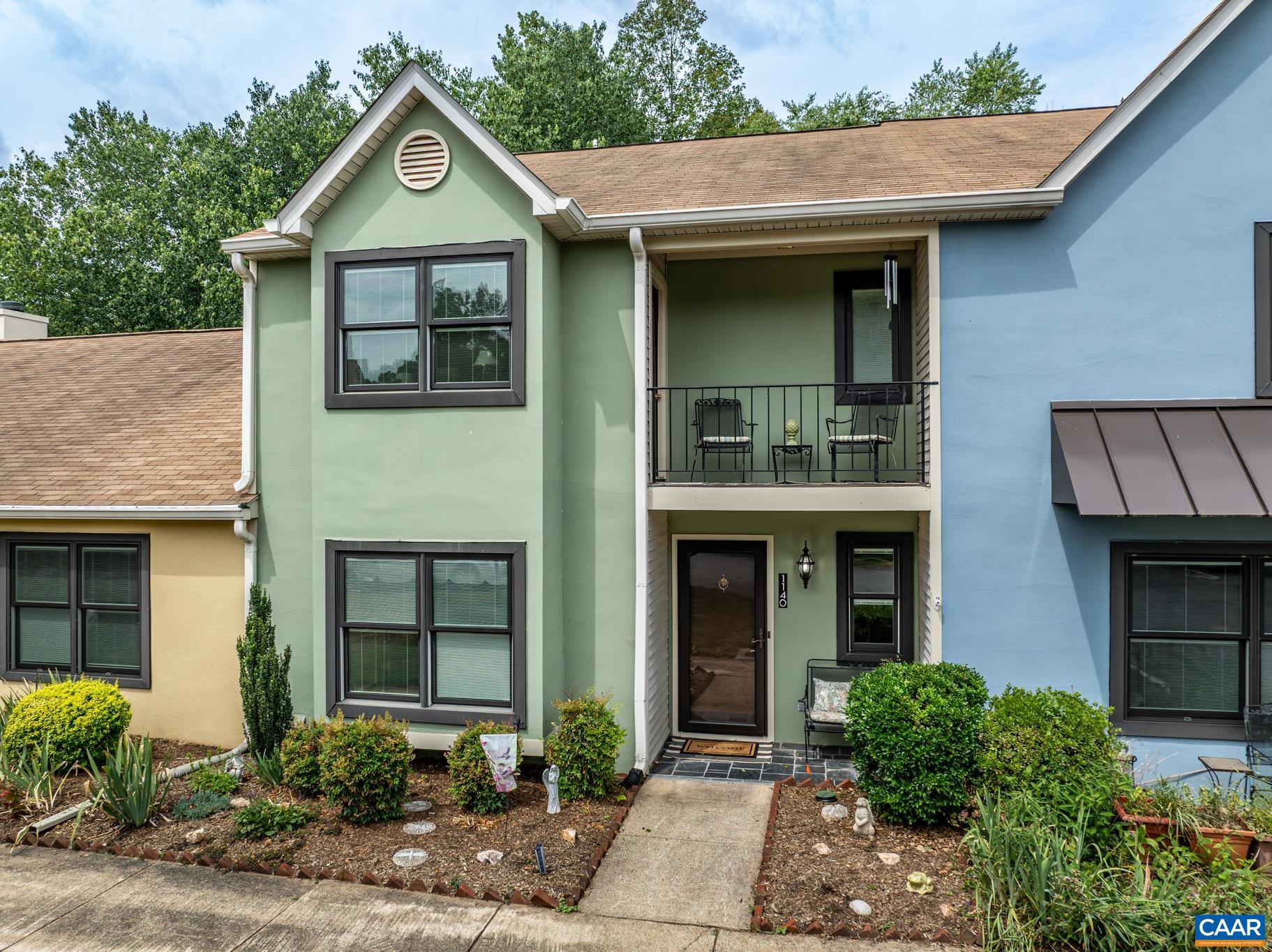
UNBEATABLE VALUE UNDER $280K IN ALBEMARLE COUNTY! Exceptional new price of $275,000 for this beautifully maintained, move-in ready Brookmill condo featuring one of the most private settings in the entire community. Tucked away on a premium lot, your private rear patio backs directly to mature woods and a peaceful stream, creating a quiet outdoor retreat you simply will not find anywhere else at this price point. Inside, this spacious 1,427 square foot layout offers an open living area centered around a warm gas fireplace, flowing easily to an updated kitchen complete with solid granite countertops, gas range, oak cabinets, and hardwood floors. The main level also features updated windows and a convenient half bath. Upstairs you will find two generous bedroom suites, each with its own dedicated full bath, plus a private elevated balcony deck off the second bedroom overlooking the trees. Enjoy low-maintenance Charlottesville living with exterior storage, plenty of parking, and quick access to Route 29, the Shops at Stonefield, dining, UVA, and downtown. Truly the best dollar-for-dollar value on the market. Schedule your private showing before it is gone!
Details
- Bedrooms
- 2
- Bathrooms
- 2.5
- Living area
- 1,427 sqft
- Price per sqft
- $193
- Lot
- 0.1 ac
- Year built
- 1990
- Type
- T
- Days on market
- 111
- MLS #
- 680115
Home details
Interior
- Heating
- Natural Gas
- Cooling
- Central AC
- Fireplaces
- Gas, Gas Logs, One
- Appliances
- Breakfast Nook, Dishwasher, Disposal, Eat-in, Gas Range, Microwave, Recessed Light, Refrigerator
- Primary bedroom on main level
- No
Structure & exterior
- Style
- Contemporary
- Roof
- Architectural Style
Utilities
- Water & sewer
- Public Water, Public Sewer
Lot & HOA
- Lot size
- 0.1 acres
- Zoning
- PUD Planne
- HOA
- 356
- Subdivision
- Brookmill
Schools
- Elementary: Agnor
- Middle: Journey
- High: Albemarle
Location & lot
Parcel boundaries and aerial imagery are from the Virginia Geographic Information Network (Virginia Base Mapping Program); flood zones are from the FEMA National Flood Hazard Layer. All are approximate, provided for general reference only, and are not a survey, a title document, or an official flood determination. Verify boundaries with a licensed surveyor and flood status at FEMA's Flood Map Service Center.